Engelsmanplaat
Mudflat hiking Wadden Sea
Engelsmanplaat
Mudflat hiking in the Wadden Sea
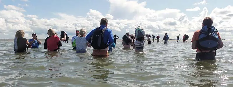
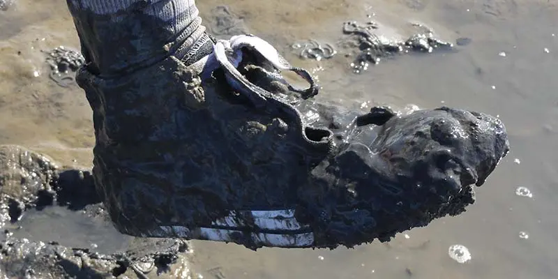
Engelsmanplaat - Along the northern coast of the Netherlands is a shallow belt of mudflats and sandy barrier islands. Usually it remains underwater, but twice a day, when the tide goes out, the waters retreat a massive expanse of tidal flats. This region is known as the Wadden Sea and it's one of the largest natural large-scale intertidal ecosystems on earth. When the tide is low, mudflat hikers can walk from the mainland to the Engelsmanplaat, a small sandbank in the Wadden Sea. The only things you need are old shoes, a tide table, a guide and a good condition.

De Kalkman
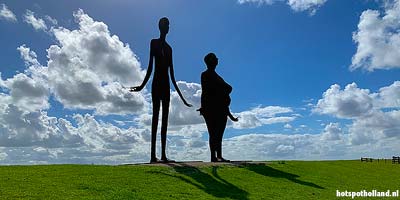
The Engelsmanplaat is approximately 0.8 square kilometers in size and is almost completely submerged at high water.It is located between the islands Ameland and Schiermonnikoog. On the sandbank there is a bird watcher's house called the 'De Kalkman'. It is an ideal beacon for mudflat walkers because it can be seen from afar. In summer, volunteers watch over the Engelsmanplaat from the bird watcher's house. In addition to these bird watchers, a single mudflat walker and a windblown bridal couple(!)), the sandbank is the domain of sandpipers, common terns and regular terns.Another beacon on the sandbar is the 'cape'. This one was installed by the government a few years ago, after the previous one had disappeared into the sea during a storm.
Het Rif (The Reef)
One kilometer past the bird watcher's house is another sandbank: Het Rif. This sandbar is located on the North Sea and protrudes slightly further above the water, so that it floods less quickly.Where does the name Engelsmanplaat come from?
One story is that an Englishman once built a house on the plate with the intention of living there permanently. The plan failed miserably. According to Wikipedia, the name 'Engelsmanplaat' probably originated from the stranding of a ship belonging to the Schiermonnikoog shell fisherman Feye Willems Engelsman in 1708. Maybe it's true, maybe it's skipper's Latin. What is certain is that the Engelsmanplaat has also been referred to by other names in the past, such as 'Ingelsche Plaet', 'Langhe Sandt', 't Hooge Sandt', 'Hooghe Banc', 'Jouerman', and the local name 'De Kalkman'. The many names are not strange in themselves. The Wadden Sea is constantly in motion. Plates and trenches are constantly changing.


Visitors rate Engelsmanplaat with 4.4 out of 5 stars
Average is based on 5 votes